Property Record
1275 Level Grove Rd, Cornelia, GA 30531


NEARBY LISTINGS FOR SALE OR LEASE
Property Detail
1275 Level Grove Rd
088-055
10-151 TR 1 441 HW 290-357
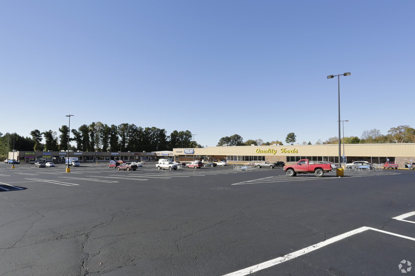
Stripcommercialcenter
Habersham
X
Georgia
13137C0218D
5.83 AC
2024
Georgia Northeast
2024
Other Market Areas
000604
Cornelia, GA
37,188 SF
DEMOGRAPHICS near 1275 Level Grove Rd
1 Mile
3 Mile
5 Mile
2024 Total Population
3,169
15,237
26,513
2029 Population
3,502
16,864
29,247
Pop Growth 2024-2029
+ 10.51%
+ 10.68%
+ 10.31%
Average Age
34
37
38
2024 Total Households
1,066
5,330
9,165
HH Growth 2024-2029
+ 10.13%
+ 10.47%
+ 10.18%
Median Household Inc
$33,035
$51,479
$55,465
Avg Household Size
2.90
2.70
2.70
2024 Avg HH Vehicles
1.00
2.00
2.00
Median Home Value
$91,762
$150,776
$164,025
Median Year Built
1986
1988
1990
Nearby Places
- Restaurants
- Banks
- Shops
- Fitness
- Groceries
Nearby Properties
Address
Land Use
TOTAL SIZE
Lot Size
Zoning
Address
Land Use
TOTAL SIZE
Lot Size
Zoning
97,144 SF
18 AC
R1A
Address
Land Use
TOTAL SIZE
Lot Size
Zoning
88,728 SF
37.73 AC
LI
Address
Land Use
TOTAL SIZE
Lot Size
Zoning
243,918 SF
42.74 AC
HI
Address
Land Use
TOTAL SIZE
Lot Size
Zoning
75,612 SF
29.13 AC
LI
Address
Land Use
TOTAL SIZE
Lot Size
Zoning
21,000 SF
28.32 AC
ARR
Address
Land Use
TOTAL SIZE
Lot Size
Zoning
28,020 SF
34.53 AC
HI
Address
Land Use
TOTAL SIZE
Lot Size
Zoning
5,632 SF
2 AC
R2
Address
Land Use
TOTAL SIZE
Lot Size
Zoning
286,488 SF
152.11 AC
HB
Address
Land Use
TOTAL SIZE
Lot Size
Zoning
166,168 SF
24.72 AC
HB
Address
Land Use
TOTAL SIZE
Lot Size
Zoning
147,903 SF
20.74 AC
HB
Address
Land Use
TOTAL SIZE
Lot Size
Zoning
116,741 SF
12.98 AC
I1
Address
Land Use
TOTAL SIZE
Lot Size
Zoning
15,883 SF
27.79 AC
HB
Address
Land Use
TOTAL SIZE
Lot Size
Zoning
210,142 SF
27.50 AC
HI
Address
Land Use
TOTAL SIZE
Lot Size
Zoning
29,770 SF
5.32 AC
HI
Address
Land Use
TOTAL SIZE
Lot Size
Zoning
21,952 SF
15.25 AC
HB
Address
Land Use
TOTAL SIZE
Lot Size
Zoning
13,072 SF
5 AC
Address
Land Use
TOTAL SIZE
Lot Size
Zoning
47,987 SF
2.02 AC
HB
Address
Land Use
TOTAL SIZE
Lot Size
Zoning
13,082 SF
9.98 AC
R2
Address
Land Use
TOTAL SIZE
Lot Size
Zoning
8,235 SF
5.01 AC
HB
Address
Land Use
TOTAL SIZE
Lot Size
Zoning
27,200 SF
19.95 AC
HB
Address
Land Use
TOTAL SIZE
Lot Size
Zoning
32,790 SF
27.23 AC
HB
Address
Land Use
TOTAL SIZE
Lot Size
Zoning
891 AC
LI
Address
Land Use
TOTAL SIZE
Lot Size
Zoning
107,183 SF
9.48 AC
HB
Address
Land Use
TOTAL SIZE
Lot Size
Zoning
153,535 SF
26.12 AC
NC
Address
Land Use
TOTAL SIZE
Lot Size
Zoning
46,851 SF
7.49 AC
HB
Address
Land Use
TOTAL SIZE
Lot Size
Zoning
25,852 SF
15.21 AC
HB
Address
Land Use
TOTAL SIZE
Lot Size
Zoning
1,800 SF
3.30 AC
HB
Address
Land Use
TOTAL SIZE
Lot Size
Zoning
7,568 SF
13.90 AC
R2
Address
Land Use
TOTAL SIZE
Lot Size
Zoning
146,295 SF
23.65 AC
NC
Address
Land Use
TOTAL SIZE
Lot Size
Zoning
6,536 SF
5.92 AC
R3
The World's #1 Commercial Real Estate Marketplace
Connect with us
© 2025 CoStar Group
The information above has been obtained from sources believed reliable. While we do not doubt its accuracy we have not verified it and make no guarantee, warranty or representation about it. It is your responsibility to independently confirm its accuracy and completeness. Any projections, opinions, assumptions, or estimates used are for example only and do not represent the current or future performance of the property. The value of this transaction to you depends on tax and other factors which should be evaluated by your tax, financial, and legal advisors. You and your advisors should conduct a careful, independent investigation of the property to determine to your satisfaction the suitability of the property for your needs.